If you're serious about sailing it's a good idea to familiarise yourself with the more traditional approach to navigation.
As on-board GPS equipment and computer tech continues to progress, our more instinctual seamanship skills become more and more underused, but there will be times when the old ways need to implemented - and getting your hands on some high quality plotting and charting instruments will mean you always have a tactile and highy reliable box of maritime tools that you can refer to whenever the situation arises.
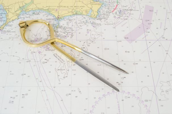
Dividers are a must-have for working out the distance between point A and point B on a chart.
But how do you use them?
Simply place one point on your starting position and the second point on the place you want to end up. Without moving or adjusting the arms of the divider, measure the distance against the latitude scale.
Remember: Always use latitude and not longitude as a point of reference and 1 minute of latitude is equivalent to one nautical mile.
What do I do if the distance is longer than the spread of my dividers?
Calibrate the dividers to a whole number, rotating each arm - you've probably seen or can picture what we're talking about! - then simply add the rotations together to get your measuring distance.
Our stunning 8 inch dividers can be used and adjusted easily with one hand, making quick and accurate measurements even easier.
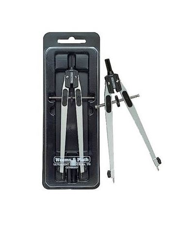
This technical drawing compass is designed for measuring distances, drawing accurate circles and providing the user with precise and detailed navigation data.
The Weems & Plath Ultralight Divider is 7 inches long and features a unique centre adjustment mechanism which allows quick, precise, one-handed operation. The compass determines and marks a position or a known distance from a given point. The instrument has stainless steel points and a coated marine alloy and plastic design to protect against corrosion.
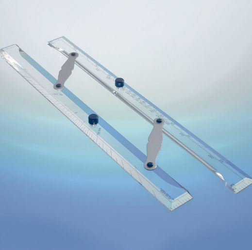
If you're looking to draw lines and plot directions on a chart or measure courses from a convenient meridian, make sure you always have a parallel ruler to hand.
The parallel ruler is split in half and connected by hinges which allows you to walk the ruler across the map to determine the direction or the true coarse, by moving it towards the nearest compass rose.
Our Middy Bar Parallel Rules from Bundell Harling are a suitable size for most vessels, ideal for night school use and made from high quality 6mm acrylic.
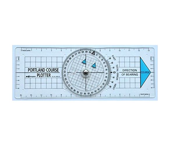
A Portland course plotter allows a seafarer to work out the course or heading of a boat.
First, establish your starting position (A) and the destination you want to end up (B), checking beforehand that your intended route won't pass over any hazards. Next, line up one of the long edges of the ruler so that it connects point A to point B and ensure that the big arrow is pointing in the direction that you want to go.
Once everything is lined up correctly, turn the centre dial so that the two little arrows are pointing upwards towards the top of the chart - which indicates the direction of 'North'. Make sure all the lines on the course plotter and chart are all correctly aligned before reading the heading, in degrees, from the zero point on the instrument.