Sea Chest

£0.00 (0) Cart Checkout

Wishlist
Sea Chest
  • Follow us on Facebook
  • Read our Blog
  • ADMIRALTY CHART DELIVERY
    Across the UK
  • WORLDWIDE SHIPPING
    Service available
  • SAILING & NAVIGATION EXPERTS
    Over 25 years experience
  • NOT QUITE RIGHT?
    14 day money back guarantee
  1. Home
  2. Blog
  3. Devon and Cornwall

Devon and Cornwall

An,Empty,Park,Bench,Overlooking,Seascape,Landscape,Of,Porthcothan,Beach

Top 10 Scenic Coastal Walks in Devon & Cornwall

Friday, 27th of August 2021

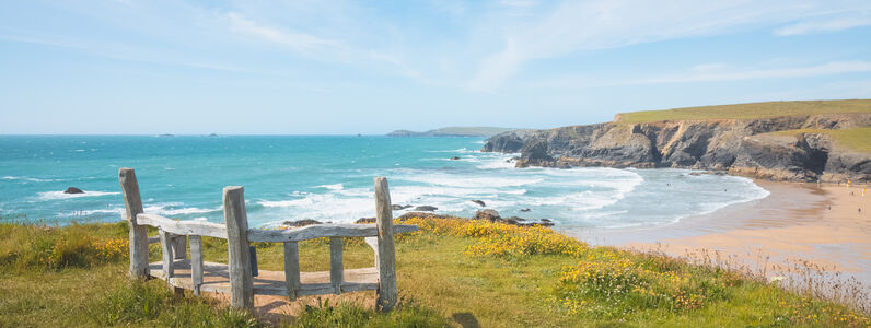
The counties of Devon and Cornwall offer some of the most scenic and varied coastal paths in the UK. The variety of walking on offer is hard to match anywhere in the British Isles. In this blog post, we have included a variety of different walks in varying

Read the full post

Categories
  • Celestial Navigation
  • Admiralty Charts
  • Books
  • Imray Charts
  • Maritime
  • Sailing
  • Uncategorized
  • Yachts
  • Gift Guides
  • Devon and Cornwall
Shop by brand
  • Reeds
  • Navionics
  • Meridian Zero
  • Royal Yachting Association
  • IMO
  • Imray
  • Fernhurst Books
  • Admiralty
Sea Chest
  • 020 3354 5017
  • sales@seachest.co.uk
  • Follow us on Facebook
  • Read our Blog

Address

  • Sea Chest
    149 Stoke Newington Road
    London
    N16 8BP

Quick Links

    • Paper Charts
    • Pilots & Guides
    • Books
    • Commercial
    • Instruments
    • Electronic Charts
    • Gifts

Support

  • Testimonials
  • Delivery
  • Returns
  • Privacy Policy
  • Terms & Conditions
  • UKHO Downloads
  • Newsletter
  • About Us
association logos
Safe and secure payment with Paypal
Reviews
  • Paper Charts
    • Atlantic
      • Azores
      • Bermuda
      • Cabo Verde
      • Canaries and Madeira
      • Folio 19 Eastern North Atlantic Ocean
      • Folio 20 North West Coast of Africa
      • Folio 24 N. Africa Gibraltar Str to Port Said
      • Folio 34 South West Coast of Africa
      • Folio 35 E. South Atlantic, S. Africa & S. Ocean
      • Folio 76 Labrador, W.Greenland, Canadian Arctic
      • Folio 78 Newfoundland
      • Folio 79 St. Lawrence Gulf & River
      • Folio 80 Cape Breton, Nova Scotia & Bay of Fundy
      • Folio 81 East Coast of United States of America
      • Folio 82 Western North Atlantic Ocean
      • Folio 83 Gulf of Mexico & Apps.
      • Folio 88 Panama Canal & Approaches
      • North Atlantic Ocean Routeing Charts
      • South Atlantic Ocean Routeing Charts
    • British Isles
      • Folio 1 South Coast of England
      • Folio 2 Bristol Channel and S. Coast of Ireland
      • Folio 3 Irish Sea, F. of Clyde, North of Ireland
      • Folio4 West Coast of Ireland
      • Folio 5 West Coast of Scotland
      • Folio 6 N & E Coast Scotland, Orkney & Shetland
      • Folio 7 North Sea F. of Forth to Thames Entrance
      • Folio 8 Rivers Thames & Medway and Approaches
      • Bristol Channel - Lands End to Milford Haven
      • Channel Islands and Adjacent Coasts of France
      • England - Dover to Felixstowe, Thames Estuary, R. Thames
      • England - East Coast - R. Humber North to Berwick
      • England - East Coas t- Felixstowe to R. Humber
      • England - Liverpool to Portpatrick inc. Isle of Man
      • England - South Coast - Dartmouth to Dover
      • England - West Country - Isles of Scilly to Dartmouth
      • Ireland - East Coast
      • Ireland - North Coast
      • Ireland - South Coast
      • Ireland - West Coast
      • Major UK Passage Charts
      • Scotland - East Coast
      • Scotland - North Coast and Orkney
      • Scotland - West Coast - N. Channel to Skye
      • Scotland - Western Isles
      • Shetland Islands
      • Wales - Milford Haven to Liverpool
    • Caribbean
      • Folio 84 Eastern part of South Coast of Cuba.
      • Folio 85 East Coast of Central America
      • Folio 86 W. Indies, S. Salv'r & Jamaica to Antigua
      • Folio 87 Guadelope to Trinidad
      • Leeward Islands
      • Windward islands Inc. Barbados
    • Mediterranean
      • Adriatic Sea
      • Corsica and Sardinia
      • Crete
      • Cyprus
      • Eastern Sporades
      • Evia and the Northern Sporades
      • Folio 18 W. Spain, Portugal & Strait of Gibraltar
      • Folio 25 Mediterranean Coasts of Spain & France
      • Folio 26 West Coast of Italy
      • Folio 27 Adriatic & West Coast of Greece
      • Folio 28 Crete & Western Aegean Sea
      • Folio 29 East Aegean & Sea of Marmara
      • Folio 30 E. Med. Rhodes to El Arish inc. Cyprus
      • Ionian Sea - Corfu to Zante
      • Italy West Coast- Sicilia - Malta
      • Major Mediterranean Passage Charts
      • Mediterranean - Spain inc. Islas Baleares
      • Mediterranean France
      • Northern Greece
      • Peloponnisos, Gulf of Patras & Corinth
      • Saronic and E. Peloponnisos
      • The Cyclades
      • The Dodecanese
    • Northern Europe
      • Germany, Netherlands, Baltic, Scandinavia, Iceland
      • Belgium & The Netherlands
      • France - North Brittany - St. Malo to Ushant
      • France - South Brittany - Ushant to Spanish Border
      • France - Dunkerque to Cherbourg
      • W. Coasts of Spain & Portugal - La Coruna to Gibraltar
      • Folio 9 E. Shores of N. Sea, Calais to The Skaw
      • Spain - North Coast - San Sebastian to La Coruna
      • Folio 10 The Baltic Sea
      • Folio 11 Gulfs of Finland and Bothnia
      • Folio 12 Northern Shores of Skagerrak
      • Folio 13 West Coast of Norway
      • Folio 14 Norway North of Trondheim to White Sea
      • Folio 15 Faeroe, Greenland & Spitsbergen
      • Folio 16 North Coast of France & Channel Islands
      • Folio 17 Bay of Biscay
    • Pacific
      • Folio 52 Yellow Sea & Gulf of Pothai etc.
      • Folio 89 West Coasts of Central America & US
      • North Pacific Ocean Routeing Charts
      • South Pacific Ocean Routeing Charts
      • Folio 52 Yellow Sea & Gulf of Pothai, etc.
      • Folio 53 Western & Southern Coasts of Japan
      • Folio 54 Inland Sea of Japan
      • Folio 55 Northern Honshu & Hokkaido
      • Folio 56 Korean Gulf, Siberia, Sakhalin & Kuril
      • Folio 57 North West Pacific Ocean
      • Folio 58 East Sulawesi to West New Guinea
      • Folio 60 Java to the Arafura Sea
      • Folio 63 North West Coast of Australia
      • Folio 64 South West Coast of Australia
      • Folio 65 S.E. Coast of Australia and Tasmania
      • Folio 66 East Coast of Australia
      • Folio 67 East New Guinea & Bismark Archipelago
      • Folio 68 New Caledonia, New Hebrides, S.Cruz etc
      • Folio 70 Fiji, Tonga, Samoa & Ellice Islands
      • Folio 71 New Zealand, North Island & Cook Strait
      • Folio 72 New Zealand, South Island.
      • Folio 73 South Eastern Pacific Ocean
      • Folio 74 North Eastern Pacific Ocean
      • Folio 89 West Coast of Central America & U.S.A.
      • Folio 90 W.Coast N.America, C.Medocino to V'couver
      • Folio 91 British Columbia
      • Folio 92 Alaska & Bering Strait
      • Folio 95 E.Coast South America C.Norte to B.Aires
      • Folio 96 E.Coast S.America, S.Part & Falklands
      • Folio 97 Magellan Strait, C. Horn to Antarctic
      • Folio 98 West Coast of South America
      • Folio 100 Antarctica
    • Rest of the World
      • Folio 41 West Coast of Pakistan & India
      • Folio 47 Western Side of China Sea
      • Folio 58 E. Sulawesi to W. New Guinea & S.E. Philippine Islands
      • Folio 60 Jawa to Arafura Sea
      • Folio 31 Black Sea & Sea of Azamov
      • Folio 32 Red Sea, Gulf of Aden & Arabian Sea
      • Folio 36 East Coast of Africa
      • Folio 37 Madagascar
      • Folio 38 Chagos Archipelago, Mauritius & Reunion
      • Folio 40 Gulf of Arabia
      • Folio 41 Pakistan and West Coast of India
      • Folio 42 Sri Lanka & Approaches
      • Folio 43 East India to Burma & Andaman Islands
      • Folio 45 Malacca Strait
      • Folio 46 W. Coast of Sumatra & Apps Singapore
      • Folio 47 Western China Sea
      • Folio 48 East China Sea & Sulu Sea
      • Folio 50 Hong Kong to Yangtze Kiang & T'ai-wan
      • Folio 59 S.& E. Borneo to W. Coast of Sulawesi
      • Indian Ocean Routeing Charts
    • Admiralty Charts
      • Admiralty Small Craft Charts
      • Standard Admiralty Charts
      • Routeing Charts and Gnomonic Charts
      • Instructional, Practice and Miscellaneous Charts
    • Imray Charts
      • UK & Ireland & full C & Y list
      • France, Spain & North Sea
      • Mediterranean & Greek Waters
      • Atlantic & Caribbean
    • NV Charts
  • Pilots & Guides
    • UK & Ireland
      • East Coast of England
      • English Channel
      • Irish Sea & Ireland
      • Scotland
    • Northern Europe
      • Arctic Ocean & Baltic Sea
      • Channel Coast of France
      • Belgium, Netherlands & Germany
    • Atlantic Ocean
      • Atlantic Islands
      • France, Spain & Portugal
      • Caribbean
      • America
    • Publishers
      • Admiralty
      • Imray
      • Fernhurst Books
      • Adlard Coles
    • Mediterranean Sea
      • France & Spain
      • Greece, Turkey & Cyprus
      • Italy, Malta & Adriatic
      • Black Sea
    • Indian Ocean & Pacific
      • Indian Ocean & Asia Pacific
      • Pacific Ocean
    • Inland Waterways
      • UK & Ireland
      • Europe
    • Sailing Directions
      • Admiralty Sailing Directions
      • Clyde Cruising Club
      • Irish Cruising Club
  • Books
    • Navigation
      • Nautical Almanacs
      • Tidal Stream Atlases
      • Tide Tables
      • Lights & Radio Signals
      • Celestial Navigation
      • Cruising Guides & Pilots
    • Instructional Books
      • Seamanship
      • Navigation
      • Rules of the Road
      • Knots, Rigging & Sails
      • Heavy Weather Sailing
      • First Aid & Safety
    • Sailing Activities
      • Dinghy Sailing
      • Powerboating & Watercraft
      • Sail Cruising
      • Sail Racing
    • Publishers
      • Admiralty
      • Imray
      • Adlard Coles
      • Fernhurst Books
      • RYA
      • Reeds
    • Technical
      • Design & Building
      • Electronics, Comms & Radar
      • Engines
      • Maintenance
    • Bunkside Reading
      • Biographical & Travel Stories
      • Nautical Fiction
      • Historical
      • Humour
      • Art & Photography
      • Children's Books
    • RYA Courses
      • Day Skipper
      • Coastal Skipper
      • Yachtmaster
    • Teaching Aids
      • Flip Cards
      • Cockpit Cards
      • Fernhurst Nautical Companions
      • Reeds Handbooks
    • Watersports
      • Paddleboarding
    • Nautical Stationery
      • Logbooks
      • Notebooks
    • SALE
  • Commercial
    • Admiralty
      • Celestial Navigation Publications
      • List of Lights - Fog Signals
      • List of Radio Signals
      • Reference Publications
      • Sailing Directions
      • Tidal Publications
    • Categories
      • Deck & Engineering
      • Passage Planning & Navigation
      • Safety & Seamanship
      • Ship Construction & Engineering
      • Cargo, Stowage & Transporation
    • Commercial Publications
      • IMO Publications
      • MCA Publications
    • Medical & First Aid
  • Instruments
    • Plotting Instruments
    • Sextants
    • Navigation Kits
  • Electronic Charts
    • Navionics
      • Navionics Platinum
  • Gifts
    • Colouring Books
    • Emma Ball
    • Mugs
    • Sailing Accessories
    • Sailing Flags
  • Find Charts
  • Superyacht Services
  • Delivery
  • Returns
  • Contact Us
  • Login
▼
▼
Close
  • Home
  • Delivery
  • Returns
  • Testimonials
  • Contact Us
  • Login