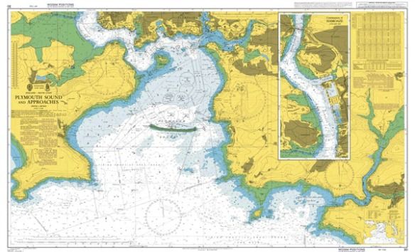
As an enduring tool of the maritime industry, nautical charts have changed dramatically over the centuries, going from disastrously unreliable to digitally accurate. Throughout this extended tenure they've served countless ocean-bound folk, from the pioneering explorers to world record breaking sailors, and even today they're invaluable to anyone who wishes to traverse the high or low seas with confidence. Below are a list of just 5 of the major maritime professions that still use Admiralty charts, and who indeed couldn't do so without them.
Container Ships
Beside mere directional guidance, the point of an Admiralty chart is to help boaters know how deep the water beneath them is, and what the land looks like underneath. For this reason, the largest of the world's vessels; container ships, use nautical charts to help them understand what is under the surface of the water. Still one of the most common means of commercial intermodal freight transport in the world, chartering a freighter ship simply isn't possible without an Admiralty charts,
which are still preferred by crews who wish to manually navigate their way around common oceanic threats, including rogue waves and pirate attacks.
Fishermen
With new updates describing the ocean floor in never before seen detail, Admiralty charts are more and more providing the world's anglers with all the information they could possibly need for their demanding job.
Even the old, reliable paper chart is a handy option, with some maps out there actually highlighting popular fishing locations with pink shading. They also provide GPS coordinates for each location, show a detailed look over a wider area and are ideal for finding useful, safe routes back to port. Digital charts, chart plotters and GPS have also benefited the fishing industry immensely, allowing trawlers and hand-casters alike to not just find spots rich in catches, but to decipher just what makes that particular area so 'fishy'.
Marine Accident Investigators
Sadly, the news is often filled with tragic stories involving boat collisions and various other accidents. Whether these were a result of poor judgement or pure accident, it is the job of Marine Accident Investigators to find out who or what was at fault, and to solve any underlying mysteries. In cases of grounding, collision and other accidents, Admiralty charts quickly become critical tools in reconstructing an event, and play a key legal role in accurately determining where the fault lies and what can be done in future to prevent similar disasters. There's a great example you can read of how Admiralty charts were used, and subsequently improved, in the investigation of
the grounding of the British Enterprise in Istanbul, Turkey in 2004.
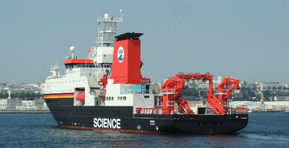
Scientific Research Vessels
Aside from hydrographic survey ships (who actually produce the data for nautical charts), there are a variety of scientific research vessels that rely on Admiralty charts in order to further the oceanic industry's collective knowledge. Antarctic maps, for example, are vital for polar explorers who need to pilot icebreaker hulls safely through ice-covered waters to serve as both polar replenishment and supply vessels to Antarctic research stations. Meanwhile,
back in November of last year, scientists at the National Oceanic and Atmospheric Administration (NOAA) were able to dispel the curiosity of countless Reddit users when they revealed that a mysterious object sitting 7 feet off the seabed of East Boston was actually just an abandoned vessel - one already listed in their own nautical charts!
Yacht Racers
Last but not least, we come to a profession where not knowing your way in the water can potentially cost you serious time and points. Admiralty charts and similar choices are becoming increasingly popular when converted onto handheld devices, with navigation apps and software seen as a vital way to get from A to B. Charts, dividers, parallel rulers, pencils, handheld compasses and binoculars are still the necessities of every speed hungry vessel, and with different chart providers offering different benefits (e.g. Navionics offer crowd sourced, up to date information, but their charts may not work with every type of software), there's plenty of approaches and preferred methods when it comes to using Admiralty charts in yacht racing.
For all future blogs relating to nautical charts and the maritime industry as a whole, keep an eye on the Seachest Facebook page, Twitter and/or Google+.